
Four years ago, the Great Lakes coastlines were in crisis.
Waters rose rapidly from historic lows in 2013 to record highs in 2020. Beaches once enjoyed by tourists and locals disappeared overnight. Houses built atop bluffs teetered dangerously close to the edge as waves ate away at the sand. Decks, beach entrances and even homes were washed into the lake. Property owners built boulder barriers along their bluffs and shores to stave off the encroaching waters.
Ethan Theuerkauf, a coastal geomorphologist and assistant professor in MSU’s Geography, Environment and Spatial Sciences Department, was contacted by many community leaders desperate for answers. They wanted to learn more about coastal erosion and how they could stop it.
He and his team trained citizens to collect data, collaborated with the State of Michigan on research and educated policymakers on best practices for coastal erosion. Then, as the waters eventually receded, so did the conversations about coastal erosion.
Without the pressure of rising waters, many communities shifted their focus to the many other issues demanding their attention. But Theuerkauf says now is the time to plan for when lake levels inevitably rise again.
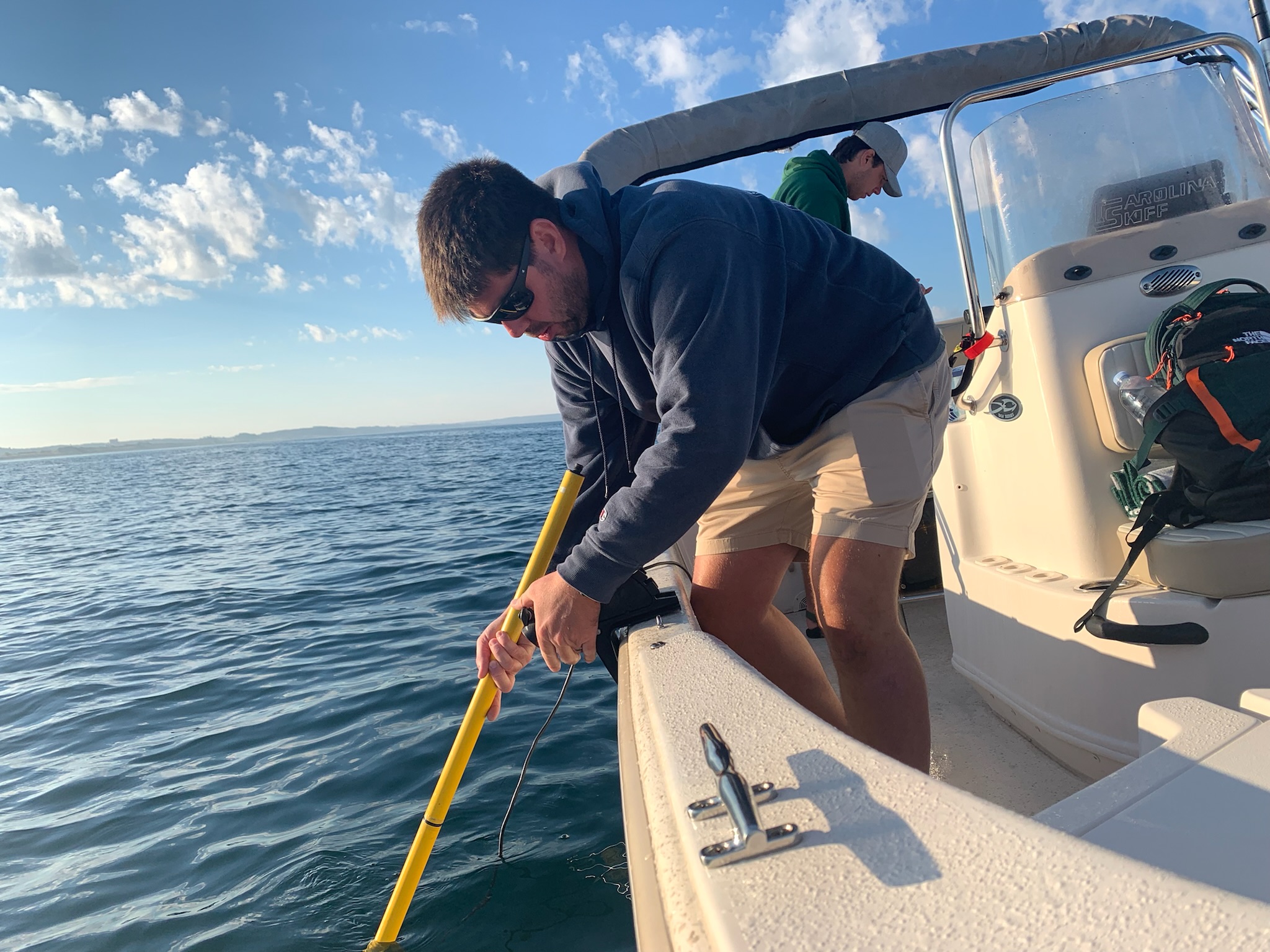
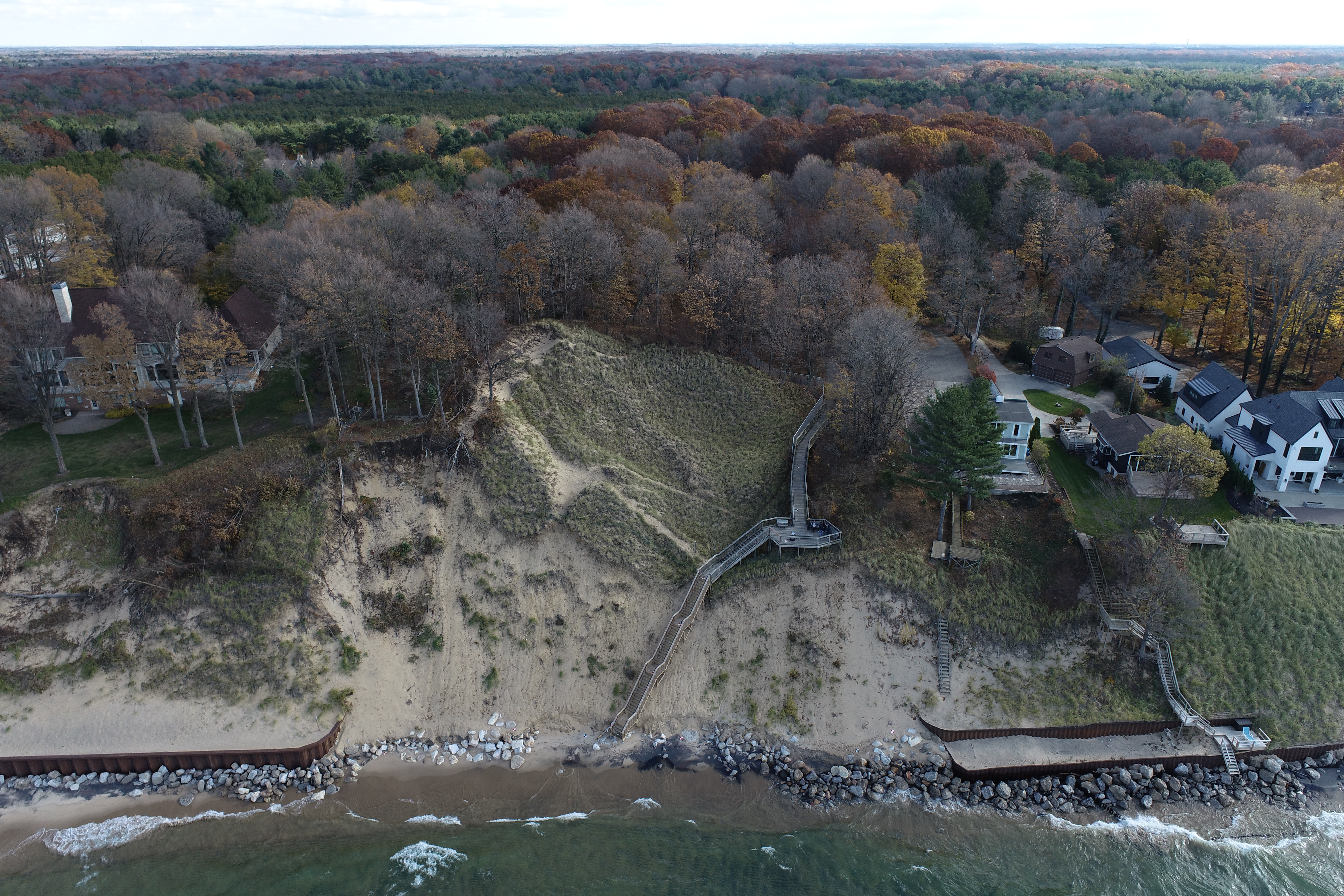
MSU Assistant Professor Ethan Theuerkauf and his lab worked with communities around Michigan to determine how sand shifts from eroding shorelines.
“We in the Great Lakes region have a tremendous opportunity to be resilient,” Theuerkauf said. “The lake levels do go down, and we have a moment to breathe and put some things into practice that will prepare us for when the lake levels rise again.”
There is no way to forecast exactly how Great Lakes coastlines might change in the future, except to say that change will happen. Unlike oceans, which are rising steadily due to the melting polar ice caps, lakes are more dependent on weather. As climate change gives way to more extreme weather, lake levels rise and fall more rapidly than ever before.
While communities can’t stop these natural processes from happening, what they can do instead is be prepared. Theuerkauf and his lab are working with the State of Michigan to equip communities with the data they need to be ready for whatever changes the ever-shifting lakes might bring.
The goal is for communities not to react to changes, but to act before those changes occur, which is called coastal resilience. With the right preparation, communities are better equipped to withstand flooding and erosion when it inevitably comes. They’re able to adapt to changing lake levels, and they can recover more quickly.
MSU research data is helping communities make policy decisions, such as property setbacks from shores and banning hard armoring such as sea walls. Leaders are learning steps they can take to protect wetlands that hold soil in place and how to use natural barriers, such as dunes, to protect coastlines.
“What it actually takes to get to resilience is data and scientific information,” Theuerkauf said. “Our research helps communities to understand why things are happening and what their proactive decisions need to be.”
Intensified by climate change
Michigan’s Great Lakes coastlines shift and change as water levels rise and fall. A year with lots of rain and melting snow brings high lake levels, while droughts cause lake levels to sink. Warm winters with little ice cover result in more evaporation and declining lake levels.
Then, when storms hit, waves beat the shoreline, often dragging sand into the water. Communities might experience flooding because of a storm, and beaches can end up underwater for the rest of the summer.
The U.S. Army Corps of Engineers has tracked Great Lake water levels since 1918. A line graph of the changing water levels shows drastic increases and decreases. Over the last century, Lake Michigan alone has seen steep peaks in 1929 and 2020, with a historic high in 1986. Conversely, water levels dipped to the lowest lows in 1926, 1964, and 2013.
The ever-changing lake levels are even more exacerbated as climate change leads to more extreme weather. Summers are hotter, storms are stronger and at times more frequent. The precipitation also intensifies waves that beat the coastlines and drag sand into the water. Unprotected shorelines can lose tens of meters in a single storm event.
As a result, lake levels can change at a rate that would be unthinkable for oceans. From 2014 to 2020, the Great Lakes rose by more than a meter. Scientists don’t expect oceans to rise by that much for another 75 years.
“But on the flip side, lake levels have also dropped by that much,” Theuerkauf said. “It’s very, very dynamic.”
Another factor is ice cover. Most Great Lake evaporation occurs in the winter months, due to the gradient between a cold atmosphere and a warm lake. When winters are more frigid, such as during a polar vortex, a sheet of ice protects lake waters from evaporation. Lake levels can then rise rapidly due to snowmelt and spring rains. Theuerkauf said that’s what led to a drastic swing from very low lake levels in 2013 to a rapid rise in 2014.
While icy coastlines can protect shores from erosion, the result is erosion further down the coastline where ice isn’t present. This freeze-thaw cycle causes ice to act as a bevel that scours out sand, forcing it to move in ways it doesn’t usually move.
Natural hazards
Flooding and erosion have always been natural hazards of coastlines. The problem is Michigan’s beaches are the heart of the economy for coastal communities.
Townships and cities along the Great Lakes count on tourists to fill their hotels, eat at their restaurants, and shop in their stores throughout June, July and August. Not only that, but many homes and businesses are built close to shorelines or on bluffs, leaving them vulnerable to damage or destruction.
Theuerkauf said his lab has moved away from predictions—largely because it’s not possible right now. In fact, modeling by the University of Michigan and the Army Corps of Engineers in Detroit suggests that more variability in weather will drive more variability in lake levels than ever before.
This uncertainty is why resilience is so important. Theuerkauf focuses his research on understanding how and why coastlines are shifting. If they can understand how weather patterns have impacted beaches, they can predict the effects future weather events might have. For example, his research could tell communities how likely it is that their beaches will come back in the future. His goal is to provide communities with the information they need to plan and make decisions.
“There’s a certain level of uncertainty that we have to live with,” Theuerkauf said. “The question is then, how do we build that into the management process to develop that resilience framework?”
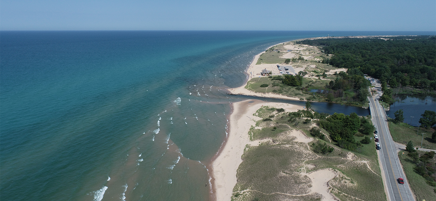
Where did the sand go?
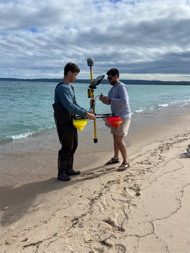
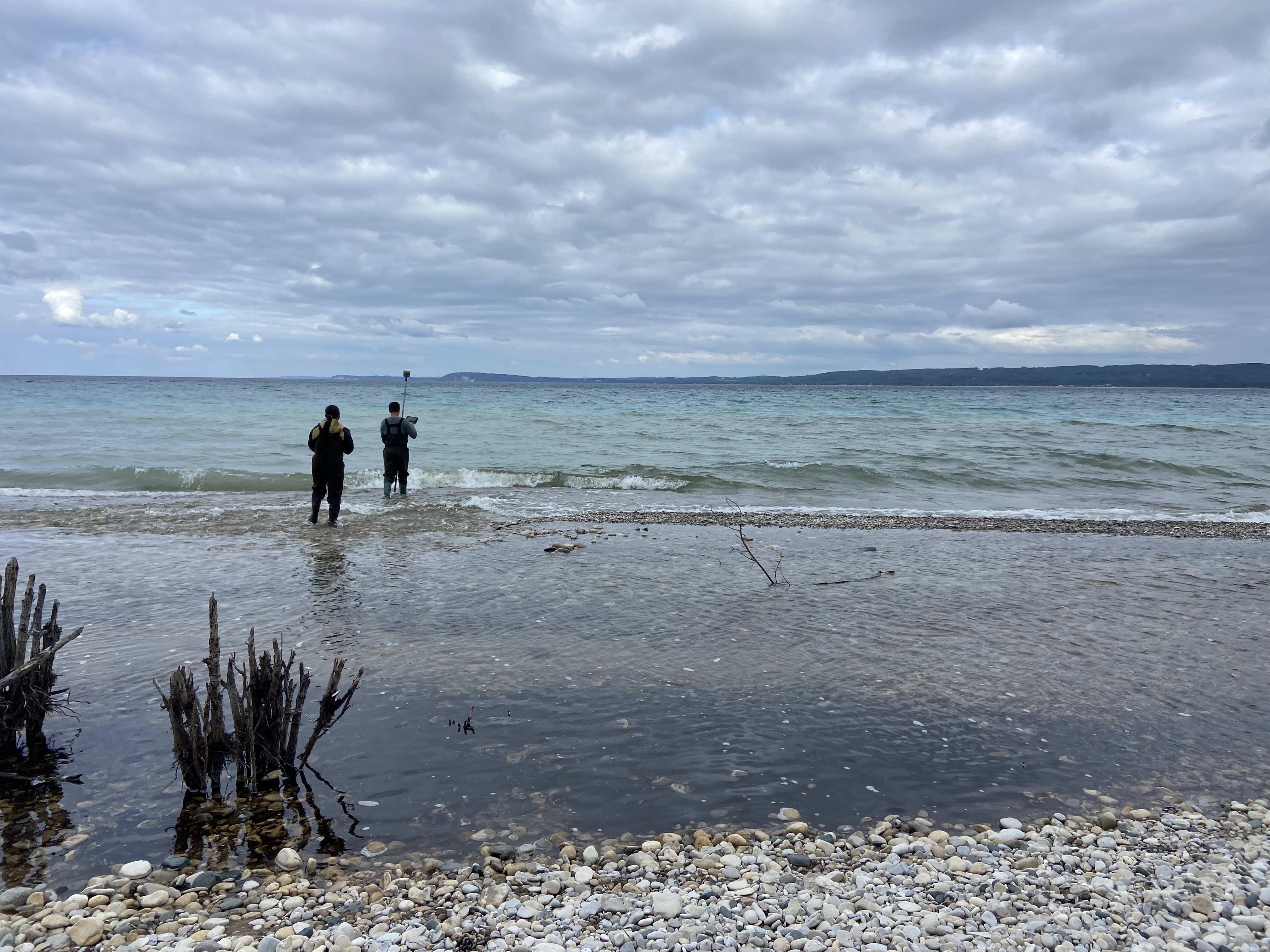
One of the first questions Theuerkauf began investigating was the one he was asked by beach communities – where did the sand go? To find out, he and his lab set out to collect data by air and water.
Thanks to a National Science Foundation grant, citizen scientists were equipped and trained to fly drones over beaches and take pictures in six communities – Marquette, Manistique, Iosco County, Chikaming Township, Manistee and South Haven. Their photos are meant to document how the coast changes with fluctuating water levels, weather and manmade structures. It’s known as IC-CREAM, or Interdisciplinary Citizen-based Coastal Remote Sensing for Adaptive Management.
Residents took hundreds of pictures over multiple years, including before and after storms. Theuerkauf’s team then combined those pictures into a digital elevation model showing how the coast changed over time.
At the same time, Theuerkauf and his team set out by boat to look for how the sand shifts offshore. By combining their mapping with information on waves, currents and water levels, they can identify how and why sand moved along the coast.
“It’s kind of like forensic science of coastal sand,” Theuerkauf said.
It turned out that one size did not fit all. Sand from flat beaches with no seawalls, such as Port Crescent State Park, was found not far from the coast and is likely to eventually wash ashore again.
However, sand from Ludington’s more open coastline with bigger waves was further offshore. And in Saugatuck, which has experienced extensive bluff erosion, Theuerkauf couldn’t find much deposited sand at all. His team could drive a boat over places that were land just 10 years before.
Once they knew where the sand was, the lab considered wave behaviors at a particular beach to determine how sand might move in the future. They looked at historical records of wave conditions for the last 30 years as well as the physics of how waves work and how they interact with sand. Based on that information, Theuerkauf could give an informed prediction of whether beach recovery is likely.
Theuerkauf is working with the State of Michigan’s Coastal Management Program as part of the state’s movement toward coastal resilience. Coastal Hazards Coordinator Emily Kirkpatrick said she hopes to extend the program even further to help the state build a dataset. Communities need that information to make good decisions that will benefit their coastlines in the future.
Hard armoring doesn’t work
Hard armoring, such as bouldering and sea walls, can inadvertently make coastal erosion worse.
When Great Lake water levels hit near-record highs in 2020, property owners scrambled to build seawalls. In 2019 and 2020, the Michigan Department of Environment, Great Lakes and Energy (EGLE) processed 3,337 permits and temporary permits for shoreline protection projects. That’s about five times the amount EGLE has processed in a normal two-year period.
In theory, revetments such as boulders piled along the shore should stop the relentless threat of erosion. The problem is seawalls disrupt natural processes and cause more erosion further along the coast.
“Many of our beaches came from the fact that dunes and bluffs erode naturally and cycle sand into the coast,” Theuerkauf said. “When you shut that cycle down, your property is protected, but you’re not adding new sediment into the cycle. It’s essentially reducing the budget of sediment that you have along the coast, making it more like the haves and have-nots of sand. That’s just generally not a resilient coast.”
Normally, waves lose energy as they break along a beach. When they crash into a hard structure instead, the energy is never lost. The waves then scour a hole under the wall or pull sand from neighboring properties.
Because the waves are pulling sand with greater intensity, the sand is dragged further out into the lake. Theuerkauf said sand that might have eventually been deposited back on the beach becomes stranded in the water and is lost.
Wetlands at risk
Wetlands are a natural buffer from coastal erosion, said Anthony Kendall, an MSU assistant professor in Earth and Environmental Sciences. Root systems from reeds and grasses absorb the impact of waves and anchor the soil in place, preventing it from being dragged into the lake.
At the same time, wetlands also absorb nutrients, such as phosphorous and nitrogen, from groundwater. These plants help to keep the Great Lakes clean by removing most of the nutrients before they ever reach the lakes.
Unfortunately, the once-robust wetlands have been altered or lost altogether, according to the State of Michigan. Communities have drained or filled in wetlands to make way for shops, restaurants and housing. Some were also removed and replaced with fields for agriculture.
Invasive species have also changed the appearance and character of wetlands, Kendall said. Tall, dense non-native Phragmites that were brought to Michigan as ornamental grass have escaped gardens and thrived in wetlands and along roadways, growing anywhere from five to seven feet tall. They’re flourishing because they grow well in high-phosphorous conditions, which result from farmers using phosphorous in crop fertilizers.
Phragmites grow so thickly that fish can’t build a habitat there, and other native plants are crowded out. And since birds don’t forage on Phragmites, there’s nothing to keep it in check. Efforts to mow it down and kill it with pesticides can seem like a losing battle.
“Ecology is a web of connections that are suddenly disturbed when the physical basis for their environment has been changed,” Kendall said. “That’s my biggest concern. They may actually provide a benefit to us, but at what cost?”
Resilience in Action
Chikaming Township Supervisor David Bunte spent his childhood summers visiting the community he now calls home. The Lake Michigan coastal township south of Warren Dunes State Park boasts a seven-mile shoreline that’s completely walkable, with no commercial businesses obstructing the beach. Eventually, he bought a vacation home in the township before becoming a full-time resident in 2015.
Summer tourism is an essential part of life in the resort community, where most residents don’t live there year-round. So, when the township’s beaches were underwater in 2020, residents were more than a little concerned.
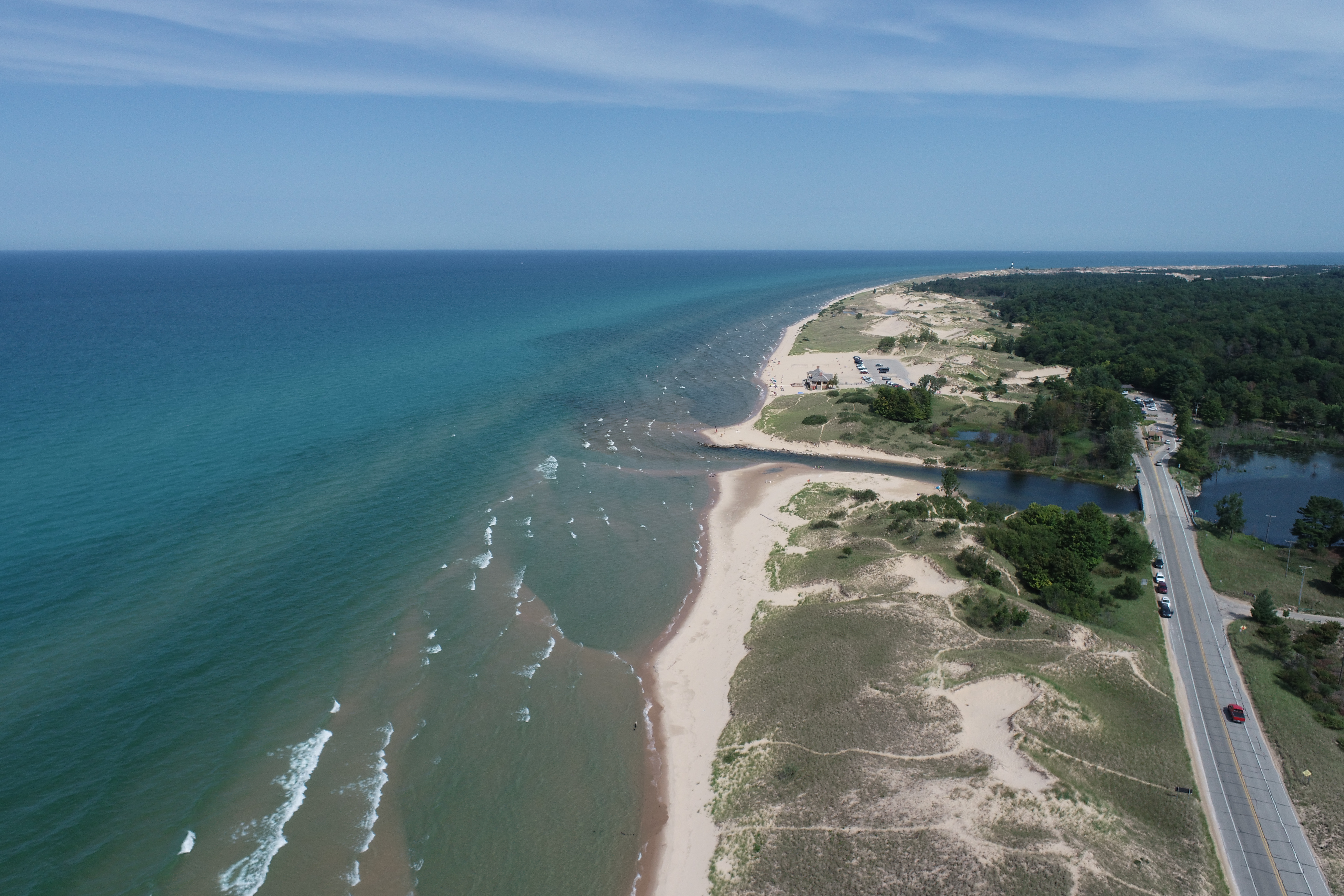
This drone photo of a Michigan shoreline was taken by a citizen working with MSU Assistant Professor Ethan Theuerkauf and his lab. Their photos over time helped map how shorelines changed over time.
Bunte said communities to the south built hard armoring structures along their coastlines to prevent erosion. Bluffs were lined with boulder revetments, seawalls were built at the edge of grassy yards, and groynes jutted out into the lake. While the changes protected those areas from erosion, they also took away the beaches and walkability of the coast.
“Our people all said we can’t let that happen,” Bunte said.
Chikaming Township was one of the first communities in Michigan to enact a hard armoring ban. The move came after a months-long community education campaign. Residents attended virtual sessions where they learned about the impact of seawalls and viewed historic data and photography showing the actual effects of erosion over time.
Since the early 1900s, the township has lost about six feet of shoreline due to erosion—a minimal amount compared to other regions, Bunte said. That’s due to the natural sand replenishment from Warren Dunes State Park to the north.
This information helped assure property owners that while lake levels might be high, they would eventually come down, and the beaches would return.
“We used the data to show people that the erosion problem would come and go and fluctuate,” Bunte said. “We cannot stop the replenishment that we have by allowing people to put up these types of revetments.”
Now that immediate danger has passed, Bunte is working with his township to work on zoning ordinances to support coastal resilience. Future erosion is always part of the discussion when considering a possible development along the shore or building a new beach access point.
“It’s got to be part of the conversation all the time,” Bunte said.
Planning is crucial
The key to resiliency is planning. For communities, that looks like building a master plan that includes shore setbacks, natural barriers when needed, and restoring wetlands that have been lost.
When properties have already been built legally near an eroding shoreline, the best solution might be a managed retreat, Theuerkauf said. That means that the structure is physically moved away from the shoreline and out of the danger zone.
No prescription applies to every shoreline because every coastal community is so different. That’s why collecting data is so important, and why Theuerkauf is committed to the work.
He and his team are continuing to work with the State of Michigan on their drone project. And Theuerkauf is still working with community leaders to think about the future and what climate change might mean for them.
Waters in the Great Lakes will rise again. When that happens, Theuerkauf wants to help communities be ready.
“I’m convinced that the code to be cracked is figuring out how to embed coastal resilience in a framework that is doable, and to meet communities where they’re at,” Theuerkauf said. “I think what it ultimately comes down to is relationships. If you build a connection with communities, then I think you can gain some traction. But it’s a long game.”
Story by Bethany Mauger