
Precision Agriculture: Soil Mapping and Measuring With a Data-Driven Approach
Soil is the foundation of all plant growth and the lifeblood of modern agriculture. For thousands of years, nature has shaped soil to help life grow and produce abundant harvests. Recently, the importance of soil health has gained more attention, as research shows that healthy soils are better equipped to withstand environmental stresses. By analyzing the soil’s chemical and physical properties, farmers can ensure a balance of nutrients and fertility, promoting robust and productive crops.
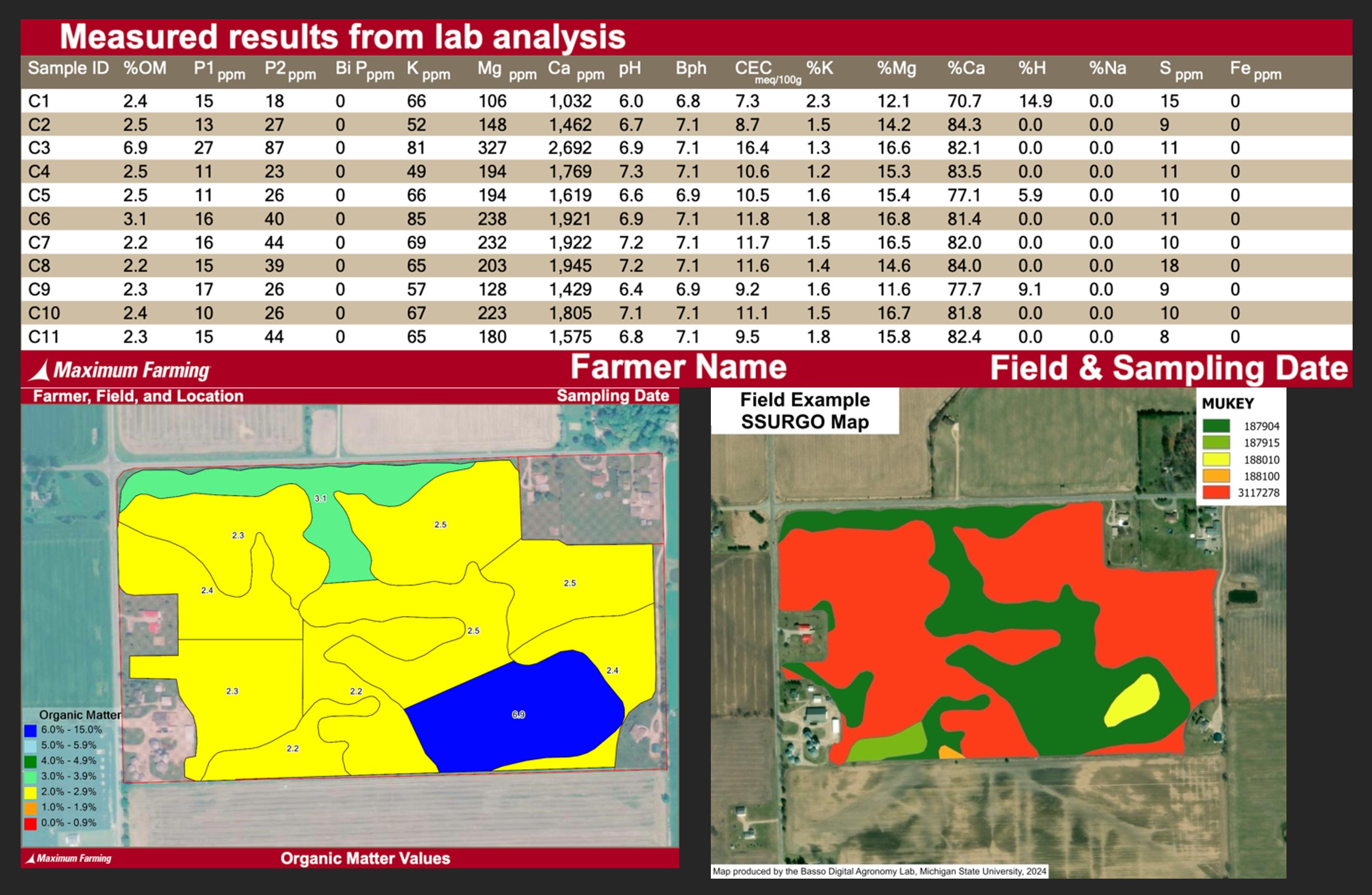
The data associated with soils is commonplace on the modern farm. These can come from sampling and laboratory analysis and are visualized as soil maps. Many farmers are familiar with these data and their value to specific operations in applying optimal amounts of phosphorus (P), potassium (K), lime and micronutrients. Establishing management zones before sampling is critical to ensure that results are valid and accurate. Effective sampling requires careful consideration of spatial variations within the field to avoid inefficiencies and unnecessary costs. Outlined in this article are different ways to visualize these spatial patterns.
Soil maps are available for the entire continental U.S. through the National Resource Conservation Services (NRCS) web soil survey. These static maps are a digitized format of the soil survey booklets historically found at the Farm Service Agency locations across the state. From the maps, the Soil Survey Geographic Database (SSURGO) provides mapping units that contain information such as taxonomic classification, slopes, soil texture, drainage classification and other data collected by the NRCS in the past century. Available on the web, these data can be viewed through a browser on your desktop, tablet or mobile device and are also available for download, which delivers the data in a shapefile format. These data serve as a strong baseline and starting point that accurately reflect spatial patterns across the field. The defined zones reveal important insights into field variability, helping improve the understanding of soil conditions.